Soil Survey: How to Read a USDA Soil Map for Your Property
A soil survey is the free USDA inventory of what is actually under your yard: the soil series, its texture, drainage class, depth to water table, and available water capacity, mapped county by county and published online at the NRCS Web Soil Survey (websoilsurvey.nrcs.usda.gov). Most homeowners run a soil test for pH and nutrients but never pull the soil survey, which means they miss the permanent traits that decide which grass survives, how long to run irrigation, and whether a low spot will ever drain. This guide shows you how to look up your soil in about ten minutes, how to read the map unit, and what each line in the report means for planting and building. The Web Soil Survey covers more than 95 percent of U.S. counties, per the NRCS, and there is no charge or account required.
What is a soil survey?
A soil survey is a field-verified map and database of the soils in a defined area, built by the National Cooperative Soil Survey over roughly a century of walking the land, digging pits, and sending samples to labs. It names each mapped area by its dominant soil series and records permanent physical traits: texture, drainage, slope, restrictive layers, and depth to water table. The data lives in the Soil Survey Geographic Database (SSURGO) and is refreshed every October 1 by the NRCS Annual Soils Refresh.
A soil survey describes inherent, slow-to-change properties. A soil test, by contrast, measures transitory chemistry (pH, phosphorus, potassium, organic matter) that shifts season to season with what you grow and amend. You want both. The survey tells you what you are working with; the test tells you what to add this year. Our companion guide to NPK fertilizer selection covers the test side.
Soil survey vs soil test: which one answers your question
Use a soil survey for permanent site facts (drainage, texture, depth to water, slope) and a soil test for what you can change (nutrient levels and pH this season). The survey is free and instant online; a lab soil test usually costs $15 to $30 through a land-grant university extension lab and takes one to two weeks. Pull both before a major project.
| Question | Soil survey (free, online) | Soil test (paid, lab) |
|---|---|---|
| What soil series and texture do I have? | Yes | Estimates texture only |
| How well does this spot drain? | Yes (drainage class) | No |
| Depth to water table or bedrock | Yes | No |
| Current pH and nutrient levels | No (general range only) | Yes |
| How much fertilizer to add | No | Yes |
| Available water capacity | Yes | No |
| Cost | $0 | $15 to $30 typical |
How to look up your soil on the Web Soil Survey, step by step
Open websoilsurvey.nrcs.usda.gov, define your property as an Area of Interest, view the Soil Map, read the map unit, then explore or download the report. The four-step flow (Area of Interest, Soil Map, Soil Data Explorer, Shopping Cart) is the NRCS structure, and the whole lookup takes about ten minutes the first time. You do not need an account.
- Go to websoilsurvey.nrcs.usda.gov and click the green Start WSS button.
- On the Area of Interest (AOI) tab, use the Quick Navigation box on the left to enter your Address (or latitude and longitude, or state and county) and click View. The map zooms to your location.
- Click the AOI Polygon (or rectangle) tool, then click points around your lot to outline it. Double-click the last point, or hold Control and click, to close the shape. A red-hatched area marks your AOI.
- Click the Soil Map tab. The legend on the left lists each map unit inside your AOI by symbol and name, with the acres and percent of your area each one covers.
- Click any map unit name (shown in blue) to open its description: the soil series, slope range, drainage class, depth to water table, and available water supply.
- For deeper data, click the Soil Data Explorer tab, then an inner tab: Suitabilities and Limitations for Use, Soil Properties and Qualities, or Soil Reports. These rate the soil for lawns, gardens, septic fields, foundations, and more.
- To save a report, click Add to Shopping Cart on the items you want, then the Shopping Cart (Free) tab. Uncheck “How Soil Surveys Are Made” and “References” if you do not need them, click Check Out, and select Get Now to download the PDF (or Download Later to have it emailed).
How to read the map unit
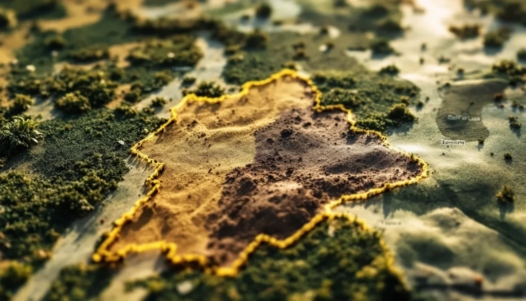
The map unit is the named soil polygon under your AOI, labeled by a symbol and a name such as “MoB, Mohall sandy clay loam, 1 to 3 percent slopes.” The first word is the soil series, the texture phrase tells you the surface texture, and the percentage is the slope range. Click through to see drainage class, depth to water table, and available water capacity. One yard can contain two or three map units, so check each one.
Texture is the single most useful line for lawn and garden decisions. The NRCS groups textures as coarse (sands, loamy sands, sandy loams), medium (loams, silt loams), and fine (clay loams, silty clays), and texture drives drainage, water-holding capacity, and how often you water. Sandy soils drain fast and need frequent short watering; clay soils hold water and nutrients but drain slowly and crust over.
If you also want to map your lawn’s square footage before planning irrigation or fertilizer, our guide on measuring lawn square footage pairs well with the AOI you just drew.
What drainage class tells you
Drainage class describes how often and how long a soil stays saturated under natural conditions, and the NRCS recognizes seven classes from excessively drained to very poorly drained. It is the fastest read on whether a spot will pond, whether a basement will stay dry, and whether a septic drain field can work. Match your plant and irrigation choices to the class rather than fighting it.
| Drainage class | What it means | What to do with it |
|---|---|---|
| Excessively / somewhat excessively drained | Water leaves very fast; coarse, sandy soils | Drought-prone; water short and often, choose tolerant grasses and natives |
| Well drained | Water moves through freely; rarely saturated | Ideal for most turf and beds; standard irrigation |
| Moderately well drained | Wet for short periods in some seasons | Fine for lawns; avoid compacting when wet |
| Somewhat poorly drained | Wet long enough to limit some plants | Improve grading or add subsurface drainage for sensitive plants |
| Poorly / very poorly drained | Stays wet much of the year; high water table | Rain garden, wet-tolerant plants, or engineered drainage; flag for septic and foundation review |
For chronically wet spots, working with the drainage instead of against it usually wins. Our build guide for a backyard rain garden covers how to turn a poorly drained low area into a feature that manages runoff.
What the data means for planting your lawn and garden
The survey turns guesswork into specifics: texture and available water capacity tell you how long to run sprinklers, drainage class tells you which grass and plants will survive, and slope and restrictive layers warn you where roots and water will stall. Read the map unit first, then choose grass and irrigation to fit it, not the other way around.
- Available water capacity is the plant-available water the soil holds between field capacity and wilting point. Low values (coarse, sandy soils) mean frequent short irrigation; high values (loams, silt loams) hold more and need less frequent, deeper watering.
- Texture and drainage point to grass choice. Fast-draining sandy soils suit drought-tolerant and warm-season grasses; heavier soils that hold water support a wider range but need aeration to fight compaction.
- Restrictive layers and depth to water table tell you where roots stop. A shallow hardpan or high water table limits deep rooting and can drown plants in wet seasons.
- Slope drives runoff. Steeper map units lose irrigation to runoff, so cycle-and-soak watering (several short cycles) beats one long run.
If your survey flags compacted, shallow, or poorly drained soil, that often explains thin turf. See our diagnosis guides on getting grass to grow in tough spots and matching a seasonal maintenance schedule to your conditions.
What the survey means for building, septic, and foundations
The Soil Data Explorer rates your map unit for septic drain fields, dwellings with and without basements, lawns and landscaping, and local roads. Soils that are poorly drained, shallow to bedrock, or high in clay shrink-swell get flagged as “very limited,” which is a real cost and design signal before you dig. The survey is a screening tool, not a substitute for the on-site percolation or soil evaluation your county requires for a permit.
For septic, soil that drains too slowly cannot treat and disperse wastewater, and soil that drains too fast sends effluent through before it is filtered. Most jurisdictions require an on-site soil evaluation regardless, but the survey tells you upfront whether a conventional system is even plausible. For foundations, high shrink-swell clay and a shallow water table are the two flags that drive engineering and drainage costs.
How current and accurate is the data
The Web Soil Survey is refreshed every October 1 through the NRCS Annual Soils Refresh, which adds new data and updates existing interpretations. The mapping is detailed and field-verified, but it is mapped at a landscape scale, so one polygon can include minor soils not called out by name. Treat it as an authoritative starting point, then confirm spot-specific conditions (a buried fill area, an old garden bed, a wet corner) with a hand auger or a lab soil test.
Accuracy is high where it matters for planning: SSURGO is described by the NRCS as the largest public natural-resource database of its kind, covering more than 95 percent of U.S. counties. A handful of remote or recently surveyed areas may show as “not available” or use older mapping, in which case the state NRCS office is the next stop.
Putting it to work
Pull your soil survey before any planting plan, irrigation install, or hardscape project, then pair it with a current soil test for chemistry. The survey gives you the permanent facts (series, texture, drainage, water capacity) free in ten minutes; the test gives you this year’s pH and nutrient targets. Together they replace guesswork with a real site profile, which is what separates a lawn plan that holds up from one that fails the first wet spring.
Next steps from here: budget the project with our 2026 lawn care cost benchmarks, and if drainage or grading work is involved, vet the crew with our contractor verification checklist.
Last reviewed: June 2026
HMNDP Editorial Team, reviewed by HMNDP turf and horticulture editors.
Frequently asked questions
How do I look up the soil type for my property?
Go to websoilsurvey.nrcs.usda.gov, click Start WSS, and on the Area of Interest tab enter your address in Quick Navigation. Use the AOI Polygon tool to outline your lot, then click the Soil Map tab. The legend lists each soil map unit by name. Click a name to see the series, drainage class, and water capacity. It is free and takes about ten minutes.
Is the Web Soil Survey free?
Yes. The USDA NRCS Web Soil Survey is free, with no account or login required, and you can download a custom PDF report at no charge. It covers more than 95 percent of U.S. counties and is available 24 hours a day. The Shopping Cart tab is labeled Free because exporting your report costs nothing.
What is the difference between a soil survey and a soil test?
A soil survey maps permanent traits like soil series, texture, drainage class, and depth to water table, and it is free online. A soil test, run by a lab for about $15 to $30, measures changeable chemistry: pH, phosphorus, potassium, and organic matter. Use the survey for site facts and the test for what to amend this season. You want both before a major project.
What does drainage class mean on a soil survey?
Drainage class describes how often and how long a soil stays saturated naturally, across seven NRCS classes from excessively drained to very poorly drained. It tells you whether a spot will pond, whether a basement stays dry, and whether a septic field can work. Match grass and irrigation to the class: water sandy excessively drained soils more often, and add drainage or wet-tolerant plants where soils are poorly drained.
What is a soil map unit?
A soil map unit is a named polygon on the survey map, labeled by a symbol and a name such as Mohall sandy clay loam, 1 to 3 percent slopes. The first word is the soil series, the texture phrase is the surface texture, and the percentage is the slope range. Click it to see drainage class, depth to water table, and available water capacity. One yard can contain several map units.
How often is the soil survey data updated?
The Web Soil Survey is refreshed every October 1 through the NRCS Annual Soils Refresh, which adds new soil data and updates existing interpretations. The mapping is field-verified but drawn at a landscape scale, so a single polygon may include minor soils not named. Use it as an authoritative starting point and confirm spot conditions with a hand auger or lab soil test.
Can a soil survey tell me where to put a septic system or foundation?
The Soil Data Explorer rates each map unit for septic drain fields and dwellings, flagging poorly drained, shallow, or high shrink-swell clay soils as very limited. That is a useful screening signal before you dig. It is not a substitute for the on-site percolation test or soil evaluation your county requires for a permit, but it tells you upfront whether a conventional system is plausible.
What does the soil survey tell me about which grass to plant?
Texture, drainage class, and available water capacity together point to grass choice and watering. Fast-draining sandy soils with low water capacity suit drought-tolerant and warm-season grasses watered short and often. Heavier loams hold more water and support a wider range but need aeration to fight compaction. Read the map unit first, then pick grass and irrigation to fit the soil.