By the HMNDP Editorial Team. Last reviewed: June 2026.
What the soil triangle is
The soil triangle is a USDA diagram that classifies soil texture from the percentages of sand, silt, and clay it contains. It is an equilateral triangle with one particle type on each side. You plot a single point from three percentages that add up to 100, and the zone that point lands in names your soil texture class, such as loam, sandy loam, or silty clay.
The full name is the USDA soil texture triangle, also written as the soil textural triangle. The United States Department of Agriculture Natural Resources Conservation Service (NRCS) maintains it. It is the standard classification tool used in soil science courses, agronomy, and land assessment across the United States.
Texture refers only to the mineral particle sizes, not organic matter, structure, or chemistry. Two soils with identical texture can still differ in fertility and pH, which is why a texture reading pairs well with a separate soil pH test when you plan amendments.
The three particle types: sand, silt, and clay
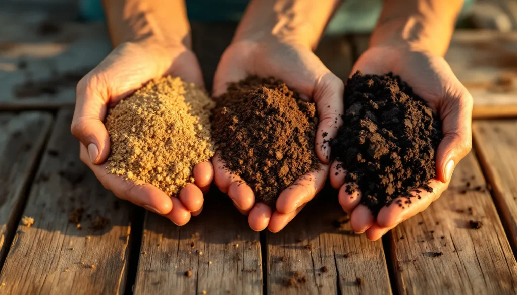
The soil triangle is built on three mineral particle sizes defined by the USDA: sand (2.0 to 0.05 mm), silt (0.05 to 0.002 mm), and clay (smaller than 0.002 mm). Sand feels gritty and drains fast. Silt feels floury or smooth when dry. Clay feels sticky when wet and forms hard clods when dry. Only particles 2 mm and smaller count; anything larger is gravel.
| Particle | USDA size range | Feel | Behavior |
|---|---|---|---|
| Sand | 2.0 to 0.05 mm | Gritty | Fast drainage, low water and nutrient holding |
| Silt | 0.05 to 0.002 mm | Smooth, floury | Moderate drainage, holds water well |
| Clay | Below 0.002 mm | Sticky when wet | Slow drainage, high water and nutrient holding |
Particle size, not mineral type, drives the difference. Smaller particles pack more tightly and expose more surface area, so clay holds the most water and nutrients but drains slowest. This single fact explains most of what texture predicts in the field.
The 12 USDA soil textural classes
The USDA soil triangle divides into 12 named texture classes. Each class is a zone bounded by specific percentage ranges of sand, silt, and clay. Loam sits near the center as a balanced mix. The names combine the dominant particles, so a soil that is mostly sand with some clay influence is a “sandy clay loam.” Clay classes cluster at the top, sand classes at the bottom-left corner, silt classes at the bottom-right.
| Texture class | Rough character |
|---|---|
| Sand | 85%+ sand, very gritty, drains very fast |
| Loamy sand | Mostly sand with slight binding |
| Sandy loam | Sand-dominant but workable, common garden soil |
| Loam | Balanced sand, silt, clay; ideal for most plants |
| Silt loam | Silt-dominant, soft and smooth |
| Silt | 80%+ silt, floury, rare |
| Sandy clay loam | Gritty but plastic, moderate clay |
| Clay loam | Sticky and firm, holds water |
| Silty clay loam | Smooth and sticky, slow draining |
| Sandy clay | Gritty and very sticky, high clay |
| Silty clay | Very smooth, very sticky, dense |
| Clay | 40%+ clay, hard when dry, drains poorly |
Loam, sandy loam, and silt loam cover most cultivated soils. The pure end-member classes (sand, silt, clay) are less common because real soils usually mix all three particles.
How to read the soil triangle (the axis confusion explained)
Each side of the soil triangle reads in one direction only, and the directions are not intuitive. The single most common mistake is reading an axis the wrong way. Clay is the percentage measured up the left side, increasing as you go up. Sand is read along the bottom but increases right to left. Silt is the right side, increasing top to bottom. Each value follows gridlines parallel to a different side, not straight across.
Here is the part that trips up nearly everyone. The gridlines for each component run parallel to one of the three sides, never perpendicular to the axis you read from. So when you mark clay, you follow a line running parallel to the bottom (horizontal). When you mark sand, you follow a line slanting parallel to the right side. When you mark silt, you follow a line slanting parallel to the left side.
| Component | Read from | Increases | Gridlines run parallel to |
|---|---|---|---|
| Clay | Left side | Bottom to top | The bottom (horizontal lines) |
| Sand | Bottom side | Right to left | The right side |
| Silt | Right side | Top to bottom | The left side |
A reliable check: any two of the three gridlines will intersect at one point, and the third should pass through that same point. If your three lines do not meet at one spot, you read an axis backward. Re-check the sand axis first, since its right-to-left direction is the most counterintuitive.
The three percentages must add up to 100%
Sand, silt, and clay percentages on the soil triangle must total exactly 100%. The triangle treats these three as the entire fine-earth fraction (particles under 2 mm), so they are complementary by definition. If you know two values, the third is fixed. For example, 40% sand and 40% silt forces clay to 20%, because gravel, organic matter, and water are excluded from the calculation.
This is why the diagram works at all. A point on an equilateral triangle has exactly three perpendicular distances to the sides that always sum to the triangle’s height. Mapping those distances to percentages that sum to 100 is what lets one point encode three values. If your lab numbers do not total 100, renormalize them before plotting (divide each by the sum, then multiply by 100).
Worked example: plot a point step by step
To find a texture class, plot one point from three percentages following each axis in its correct direction. Take a sample that lab analysis reports as 40% sand, 40% silt, and 20% clay. Follow the steps below and the point lands squarely in the loam zone near the center of the triangle. This is the walkthrough most diagrams leave out.
- Confirm the values total 100% (40 + 40 + 20 = 100). Good.
- Clay (20%): from the left side at the 20 mark, draw a line running parallel to the bottom (horizontal).
- Sand (40%): from the bottom side at the 40 mark, draw a line running parallel to the right side, slanting up and to the left.
- Silt (40%): from the right side at the 40 mark, draw a line running parallel to the left side, slanting down and to the left.
- The three lines meet at one point. Read the labeled zone it sits in.
- Result: loam. A balanced soil that drains well and holds nutrients, ideal for most lawns and gardens.
You only need two of the three lines to fix the point, since the percentages sum to 100. Drawing the third is the accuracy check described earlier: all three should cross at the same spot.
Handling boundary lines between classes
When your point lands on or near a line between two soil texture classes, name it by the more specific (finer) class and note the uncertainty. Boundary cases are common because lab results carry a few percentage points of error. A point at the loam and clay loam border could read either way depending on whether your clay figure is 27% or 28%, which is the exact USDA cutoff at that edge.
Three practical rules for edge cases:
- Round before plotting, not after. A 0.5% rounding swing can flip a borderline class. Keep one decimal until the final read.
- Re-run a field feel test. If lab and triangle disagree at a boundary, the ribbon test (below) often settles which side dominates behavior.
- State the boundary honestly. “Clay loam, near the loam boundary” is more useful for amendment decisions than a single forced label.
This boundary nuance is where most published guides stop short. The class name is a tool for decisions, not a verdict, so a point near a line means you treat the soil as a blend of both behaviors.
The field test: estimate texture without a lab
The ribbon or bolus test estimates soil texture by hand in minutes, no lab required. You wet a small sample to a putty consistency and try to push it into a ribbon between thumb and forefinger. How long a ribbon forms before breaking, plus the grittiness or smoothness, maps to a texture class. It is the standard NRCS field method and accurate enough for most gardening and landscaping decisions.
- Take a tablespoon of soil, remove stones and debris, and add water until it holds together like moist putty (not runny).
- Squeeze it into a ball. If it will not form a ball at all, it is sand or loamy sand.
- Push the soil out over your finger with your thumb to form a ribbon.
- Measure the ribbon before it breaks: under 1 inch suggests a loam group, 1 to 2 inches a clay loam group, over 2 inches a clay group.
- Rub a wet pinch: gritty means sand-dominant, smooth and floury means silt-dominant, sticky means clay-dominant. Combine ribbon length and feel to name the class.
| Ribbon length | Feel | Likely class |
|---|---|---|
| Will not ribbon | Very gritty | Sand or loamy sand |
| Under 1 inch | Gritty | Sandy loam |
| Under 1 inch | Smooth | Silt loam or loam |
| 1 to 2 inches | Gritty | Sandy clay loam |
| 1 to 2 inches | Smooth | Silty clay loam |
| Over 2 inches | Sticky | Clay or silty clay |
The feel test pairs naturally with the triangle: estimate the class by hand, then sanity-check against a jar sedimentation test or lab numbers when precision matters.
The interactive calculator approach (NRCS)
If you have lab percentages, an interactive calculator removes the plotting step entirely. The NRCS publishes a soil texture calculator where you type sand, silt, and clay percentages and it returns the class instantly. It enforces the sum-to-100 rule and handles boundary math precisely, which avoids the axis-direction errors common in manual plotting. Search “NRCS soil texture calculator” to reach the official tool.
Use the calculator for record-keeping and the manual triangle for understanding why a soil behaves as it does. The diagram teaches the relationships; the calculator just reports the answer. For volume planning after you know your texture, our guide on how much soil you need covers the next step.
Is the USDA soil triangle the same worldwide?
No. The USDA triangle is the United States standard, but it is not universal. The same sand, silt, and clay percentages can map to different class names under other systems because each defines particle sizes and class boundaries differently. The International Society of Soil Science (ISSS), FAO, UK, and Australian triangles all exist, and the silt size cutoff is the biggest divergence.
| System | Silt upper limit | Notes |
|---|---|---|
| USDA / NRCS | 0.05 mm | US standard, 12 classes |
| ISSS (International) | 0.02 mm | Older European standard, different boundaries |
| FAO | 0.05 mm (aligns with USDA) | Used in global soil maps |
| UK (ADAS) / Australia | 0.06 mm | Regional class names differ |
The practical takeaway: a soil called “loam” in a US lab report may carry a different label in a European or Australian one, even with identical particles. Always note which system a triangle or lab uses before comparing results across countries.
Why soil texture matters for gardening and farming
Soil texture predicts drainage, water retention, and nutrient holding, which drives almost every soil management decision. Sandy soils drain fast and dry out, so they need frequent watering and resist compaction. Clay soils hold water and nutrients but drain slowly and compact easily. Loam balances both, which is why it is the target for most lawns, vegetable beds, and row crops.
Texture cannot be changed quickly; you manage around it. Adding organic matter (compost) improves water holding in sandy soil and drainage in clay soil without altering the particle ratio. The table below translates each major group into practical decisions.
| Texture group | Drainage | Practical decision |
|---|---|---|
| Sandy (sand, loamy sand, sandy loam) | Fast | Water more often, add compost, mulch to slow evaporation |
| Loamy (loam, silt loam, clay loam) | Balanced | Low maintenance, suits most plants and turf |
| Clayey (clay, silty clay, sandy clay) | Slow | Avoid working when wet, add organic matter, consider raised beds |
Clay soils benefit from aerating the lawn to relieve compaction and improve infiltration. For more soil and turf fundamentals, the HMNDP learn hub collects related guides.
Frequently Asked Questions
How do you read a soil texture triangle?
Read each side in its own direction: clay up the left side, sand along the bottom increasing right to left, and silt down the right side. For each percentage, draw a line parallel to a different side (clay lines run horizontal, sand lines parallel to the right side, silt lines parallel to the left side). Where the lines cross names your texture class.
What are the 12 soil texture classes in the USDA triangle?
The 12 USDA classes are sand, loamy sand, sandy loam, loam, silt loam, silt, sandy clay loam, clay loam, silty clay loam, sandy clay, silty clay, and clay. Clay classes cluster at the top of the triangle, sand classes at the bottom-left corner, and silt classes at the bottom-right. Loam sits near the center as a balanced mix of all three.
How do you find your soil texture from sand, silt, and clay percentages?
Confirm the three percentages total 100, then plot a single point. Draw a horizontal line from your clay value on the left axis, a line parallel to the right side from your sand value on the bottom, and a line parallel to the left side from your silt value on the right. The three lines meet in one zone, which names your class.
What is the difference between the soil texture triangle and the soil textural triangle?
There is no difference. “Soil texture triangle” and “soil textural triangle” are two names for the same USDA diagram that classifies soil by sand, silt, and clay percentages. Some sources also call it the USDA texture triangle or soil classification triangle. All refer to the identical equilateral-triangle chart with 12 named texture classes maintained by the NRCS.
How do you determine soil texture without a lab test?
Use the ribbon (bolus) feel test. Wet a tablespoon of soil to a putty consistency, squeeze it into a ribbon between thumb and finger, and measure how long the ribbon gets before breaking. Under 1 inch indicates a loam group, 1 to 2 inches a clay loam group, over 2 inches a clay group. Grittiness signals sand, smoothness signals silt, stickiness signals clay.
Why must sand, silt, and clay percentages add up to 100%?
Because the triangle treats sand, silt, and clay as the entire fine-earth fraction (all mineral particles under 2 mm), they are complementary by definition. Gravel, organic matter, and water are excluded. If you know two values, the third is fixed. If lab numbers do not total 100, renormalize them: divide each by the sum, then multiply by 100 before plotting.
What is loam on the soil triangle and where is it located?
Loam is a balanced soil texture containing roughly 40% sand, 40% silt, and 20% clay, located near the center of the soil triangle. It drains well while still holding water and nutrients, which makes it the preferred texture for most lawns, vegetable gardens, and crops. The loam zone is surrounded by sandy loam, silt loam, and clay loam classes.
Is the USDA soil texture triangle the same worldwide?
No. The USDA triangle is the US standard, but the ISSS (International), FAO, UK, and Australian systems define particle sizes and class boundaries differently. The silt cutoff varies (0.05 mm for USDA, 0.02 mm for ISSS, 0.06 mm for UK and Australia), so identical sand-silt-clay percentages can map to different class names. Always note which system a lab or chart uses.